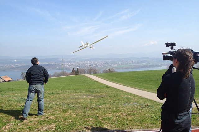
Drones create headlines. Like AI, their unfettered use plays on our most sci-fi induced fears. Military deployment both intrigues us and serves to increase our suspicions. Commerce enthusiastically explores their value to meet consumers ‘on-demand’ expectations. Natural history film-makers experiment with drone technology to give us rare access to the natural world. In June 2014, the US National Park Service banned them from 401 parks while it worked out a new management policy and this week a pilot reported sighting a UAV near the flight path of a passenger jet. It’s clear that the increasing use of drones presents complex challenges.
UAVs or Unmanned Aerial Vehicles offer intriguing possibilities for nature conservation. One dominant focus of experimentation is their use for data capture and monitoring alongside data analytics and other spatial and reporting tools. The potential of integrated digital capabilities such GPS / satellite tagging and geo-mapping, cloud services, mobile devices, camera-traps, radio telemetry, LiDAR and data from field observation, to better understand and respond to nature conservation concerns may be significant.
Suggestive of this promise, is the facility to assess biodiversity in difficult or rapidly changing terrain, to track rehabilitated species and gather data to refine reintroduction programmes or to pick-up real-time changes in animal behaviour that may indicate imminent threat of poaching. The need has never been greater. The findings of the WWF Living Planet Report 2014 are sobering: ‘Species populations worldwide have declined by 52% since 1970’. Many digitally enabled conservation projects are now underway, and hopes are high.
Professor Serge Wich, Professor in Primate Biology, Liverpool John Moores University and Lian Pin Koh (Founding Directors of Conservationdrones.org), have developed drone technology to support tracking of orangutans and to assess their habitat loss. This work produces 3d geometrically accurate computer representations of the forest in near real-time that can help for example, to detect forest fires and illegal logging activity. In the course of this work they have continued to innovate and refine their model. The orangutan drone is more robust, it employs a Google maps interface and the photo data now uses automatic object recognition to detect orangutan nests. Integrating such technology with radio collars (and in some cases small sensors implanted into newly released animals), camera-traps, spy microphones and wifi data collection, can build a far more detailed picture of the behaviour and range of endangered species. This when overlaid with other data-sets, is likely to prove a valuable tool for conservation planners, if integration challenges can be resolved.
While use of digital capabilities is broadly embraced by academics and field researchers, drones do however present some very particular issues. A number of academics working in drone research for nature conservation have for example, stressed the need for caution in their rapid deployment to support anti-poaching initiatives: the concern being to avoid creating a perception of ‘fortress conservation’. Organisations are urged to consider how on-the-ground relationships may be affected by fear of ‘sinister technologies of surveillance’, thereby undoing the significant strides made through local engagement.
Academics and field-researchers also point out that drone technology for conservation purposes is very new, and its cost effectiveness—when compared with other kinds of intervention, such as training field observers—not yet proven. Due to their use in remote environments, drones (and similar tracking technologies) are also subject to issues such as battery life, range and GPS coverage, data consistency and analytics systems management. The validity of drone data in securing poaching convictions is another area of consideration and, as the US National Park Service decision illustrates, the broader legal and political impacts are still to be thought through.
Nature conservation initiatives are often, due to their hard to navigate, large scale operating context, costly and resource-intensive. They have to overcome issues associated with prevailing political unrest, lack of economic support and natural sensitivities to local customs and concerns. Innovation in such environments requires far more thought than the simple application of technologies demonstrated to work elsewhere. Every environment and each species presents particular challenges. Digital technologies, data interpretation and local participation require a precise set of conditions to work optimally.
And there is also a danger of reinventing the wheel; solutions to many of the problems nature conservationists seek to solve might be achieved, for example, by harnessing lessons from the rapid iteration of digital health technologies (device innovation remains critical for many nature conservation projects) or by surveying solutions already in use by the military and extraction industries. Many NGOs have worked hard to establish collaborations that facilitate such valuable knowledge exchange.
In 2011 one consortium created the SMART tool (spatial monitoring and reporting software). This helps local rangers using GPS to collect data, which is analysed automatically to support the swift diversion of resources to areas of need. It’s simple, quick, and visual—using maps to present findings—and the integration of low-cost robust mobile devices enables triangulation for better navigation and synching with cameras. It will also support tracking even when turned off to preserve battery life.
Another collective, Global Forest Watch established in 2012 and led by Lilian Pintea, VP Conservation Science, has developed a platform for different groups to record and share research such as deforestation alerts. Nature conservation groups can access a common cloud-based mapping system with shared variables that also supports integration with other data sets and overlay of hi-resolution images, such as those gathered by drones.
The Jane Goodall Institute is working with local partners to exploit these advances in remote sensing for global land cover maps for chimpanzee and gorilla surveying. Many other organisations and governments are experimenting with drones in efforts to protect other particularly fragile environments. In Belize for example conservation drones now monitor the health of marine ecosystems.
It’s a significant task but recent projects of this kind are yielding valuable results. Other work that employs digital innovation and UAV capabilities to support nature conservation—beyond monitoring and data capture—includes the development of robot insects at the Harvard Robotics Lab (including robot bees which could act as a ‘stop gap’ while populations recover) and ‘Robirds’ built at the University of Twente (which connects simple digital technologies with an understanding of predator-prey relationships to keep raptors away from areas of danger such as airfields).
Digital innovation for nature conservation will benefit from cross-disciplinary creativity. The marriage of digital media, technology, on-the-ground engagement and research expertise has great potential to address concerns and improve opportunities to collaborate. The questions that persist are how best to share knowledge and harness new digital technologies and innovation? How to build on the hard work already done on the ground with policy-makers and across boundaries? How to ensure new technologies are used appropriately, are cost-effective and integrated with sensitivity to local needs and resource constraints? And most importantly of all, how can we best to employ such capabilities to protect and share the wonder of the natural world?
Lisa Sargood is director of digital strategy at Horton Wolfe and Academic Visitor at the OII. Prior to this she was Exec Producer and Commissioner for digital output across BBC Nature and BBC Science. Her projects include Spring/Autumn-watch, Blue Planet, Planet Earth, Stargazing Live, Horizon, LabUK (Brain Test Britain etc.), Big Cat Live and Virtual Revolution, which won a BAFTA and an International Emmy®. Her research focuses on the potential for digital media, technology and public engagement to support nature conservation and drive pro-environment behaviours.
Contact: [email protected] Twitter: @lisasargood