Tag: exclusion
All topics
-
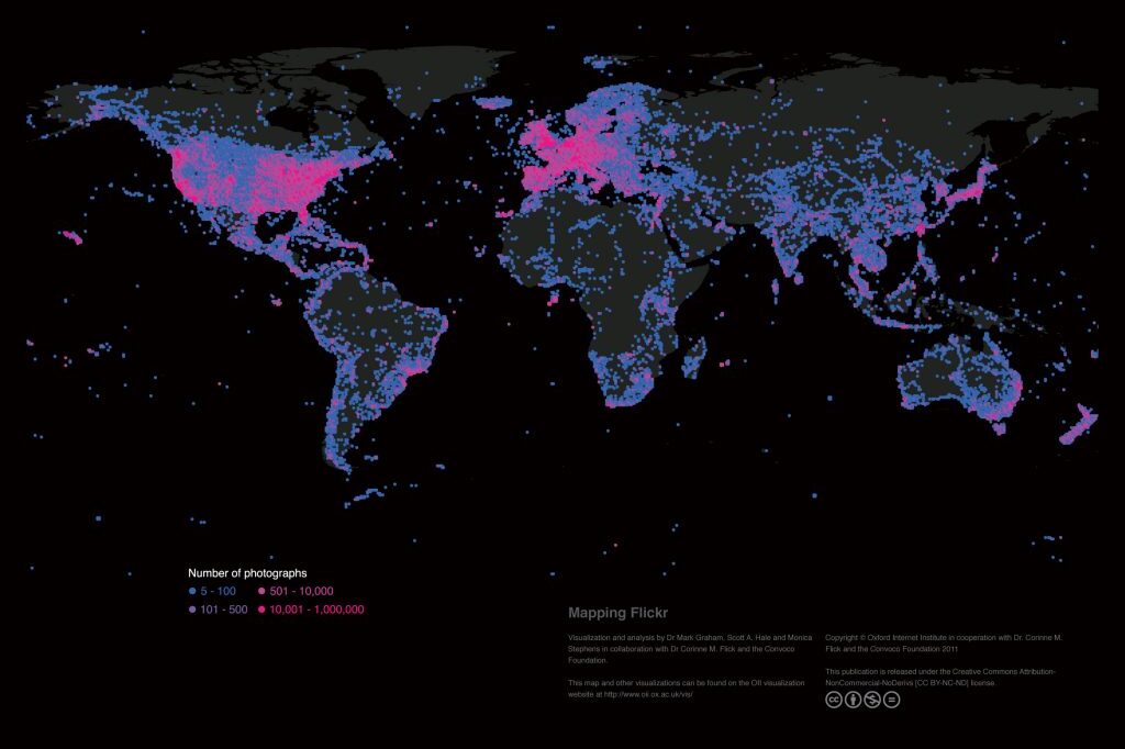
Mapping the uneven geographies of information worldwide
There are massive inequalities that cannot simply be explained by uneven Internet penetration. A range…
All topics
There are massive inequalities that cannot simply be explained by uneven Internet penetration. A range…